HIKES, WATERFALLS, & LANDMARKS
Please be respectful. Pack out your trash wherever you visit.

HIKES
-

1 - Bear Hill Nature Preserve
2 mi RT woods road walk to Bear Cliff. Herd paths around the cliffs allow for further exploration. Outstanding views from southeast to northwest. Alternative to Sam's Point for the Shawangunk cliff-top experience. NYNJTC Map 104 Shawangunk (South)
-
2 - Shawangunk Ridge State Forest Cox Road Loop
3.2 mile loop starting at Shawangunk Ridge State Forest parking on Cox Rd. This "Shawangunk Sampler" hike includes many classic Shawangunk features including deep woods, ridge-top rock slabs, dwarf pine forests, expansive views, cliffs and crevice walks. Includes a portion of the Long Path and can be combined with longer hikes originating at Roosa Gap, Mountain Rd in Spring Glen and the Shawangunk Ridge State Forest trailhead on Route 52. NYNJTC Map 106B Shawangunk Ridge.
-

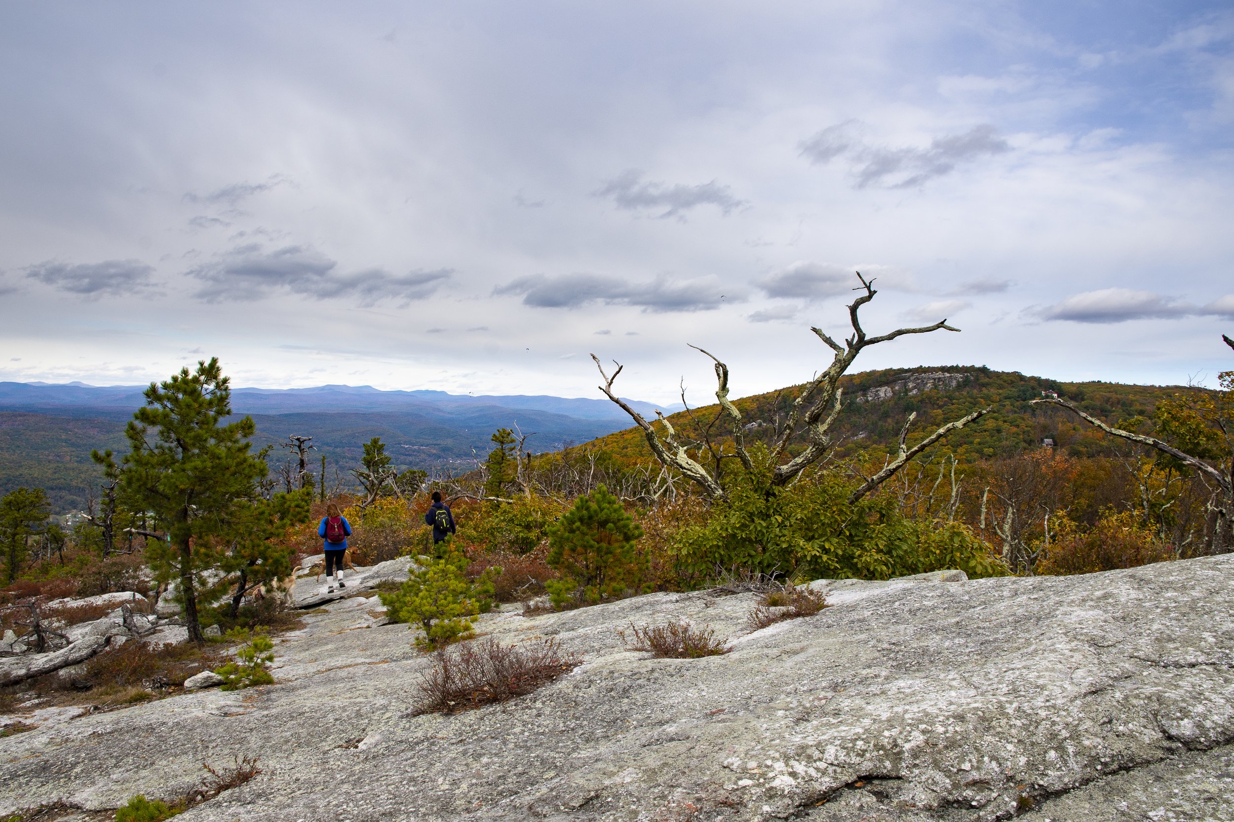
3 - South Gully to Sam's Point
The co-aligned Long Path/Shawangunk Ridge Trail ascends through South Gully from Rt 52 to Sam's Point. Highlights include deep remote woods, the pristine South Gully Brook and Diana's Bath waterfalls. In the Sam's Point area, highlights include the berry picker cabins, the Lenape Steps and Sam's Point itself. Enjoy the satisfaction of hiking to the top of the ridge at Sam's Point. Eliminates the need for a reservation at Sam's Point. NYNJTC Map 104 Shawangunk (South).
-

4 - Sam's Point Preserve
Hike options include a relatively easy gravel road walk to Sam's Point (1.2 mi. RT); a moderate hike to the ice caves (3.4 mi. RT); a moderate loop hike around Lake Maratanza (3 mi. RT); a difficult hike to Vereerderkill Falls (6.5 mi. RT), a difficult hike to Indian Rock & High Point (8 mi. RT) and the full Sam's Point Preserve loop taking in all the scenic spots (11 mi.). NYNJTC Map 104 Shawangunk (South).
-
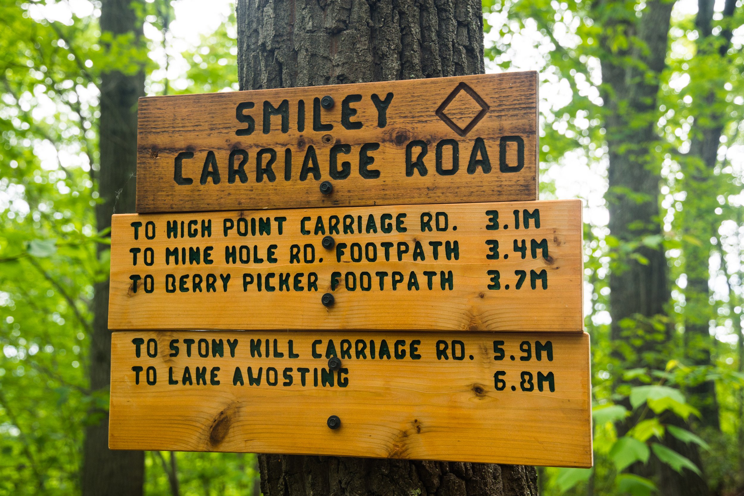
5 - Smiley Carriage Road to Napanoch Point & Beyond
Unimproved carriage road walk with long steady climb up the ridge. Mostly forested woods walk with occasional viewpoints. at the top, Napanoch Point offers great views spanning from the southwest to the northwest. Napanoch point is a primative, back-county environment. Can be extended to main Minnewaska Park carriage road network at Lake Awosting. Trail head at Berme Road Park. NYNJTC Map 104 Shawangunk (South).
-

6 - Long Path at Port Ben to Panther Rock & Napanoch Point
Short road walk through Port Ben and along old D&H Canal remains. Then climb up the Shawangunk Ridge on the Long Path. The eEnvironment transitions from deciduous forest on the slopes, to ridge top rock slabs and dwarf pines at the top. A great trek up and down the ridge. Highlights include great views from Panther Rock and Napanoch Point. Alternate starting point at Mine Hole Trail on Foordmore Rd.NYNJTC Map 104 Shawangunk (South).
-
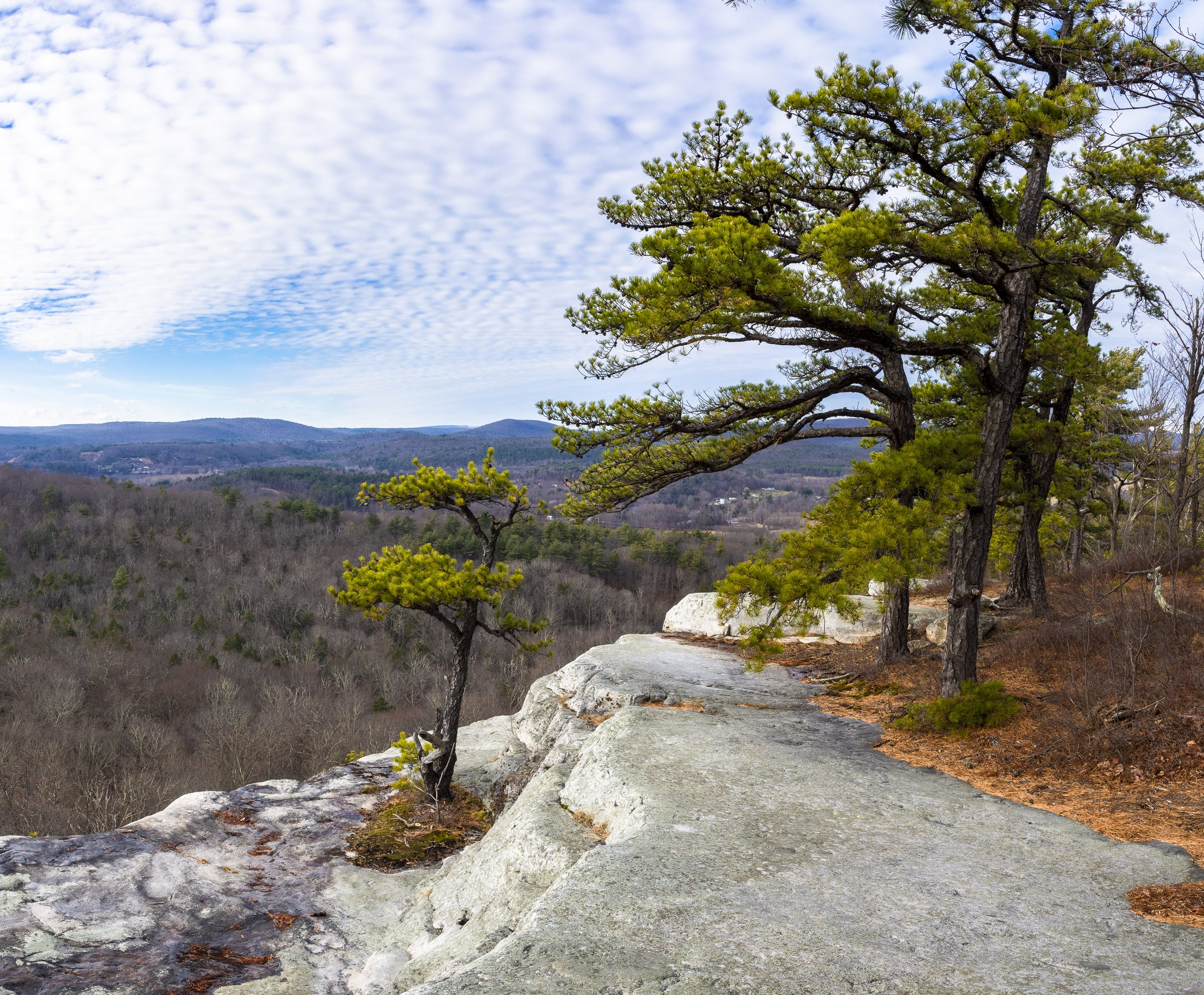
7 - Foordmore Rd to Point Lookout
Starting at the Mine Hole trail head on Foordmore Rd., walk in about 350 ft and turn left on the obvious woods road / trail. It's a short hike with a steep initial climb to a great classic Shawangunk cliff-top vista. Views to the south and west show Catskill foothills and the Mine Hole area of the northwest Shawangunk Ridge. A nice hike if you're short on time, and want to enjoy some solitude. NYNJTC Map 104 Shawangunk (South).
WATERFALLS
-

8 - Pomeroy's Falls
Vernooy Kill State Forest waterfall sits roadside off Lundy Rd in Wawarsing. A nice peaceful place to visit and relax.
-

9 - Trout Creek
Multiple levels of scenic waterfalls on NYCDEP land. Rustic area without formal trails gives the feeling of exploring. Walk down old road to the water and find your way around on informal trails and walking through the woods. Swimming is not allowed.
-

10 - Fantinekill Falls
Lovely, small waterfall park perfect for quiet contemplation. Located in rear of the Fantinekill Cemetery, and accessed by driving through the cemetery. Please respect the private residence on the property, and consider a donation to support upkeep of the cemetery.
-

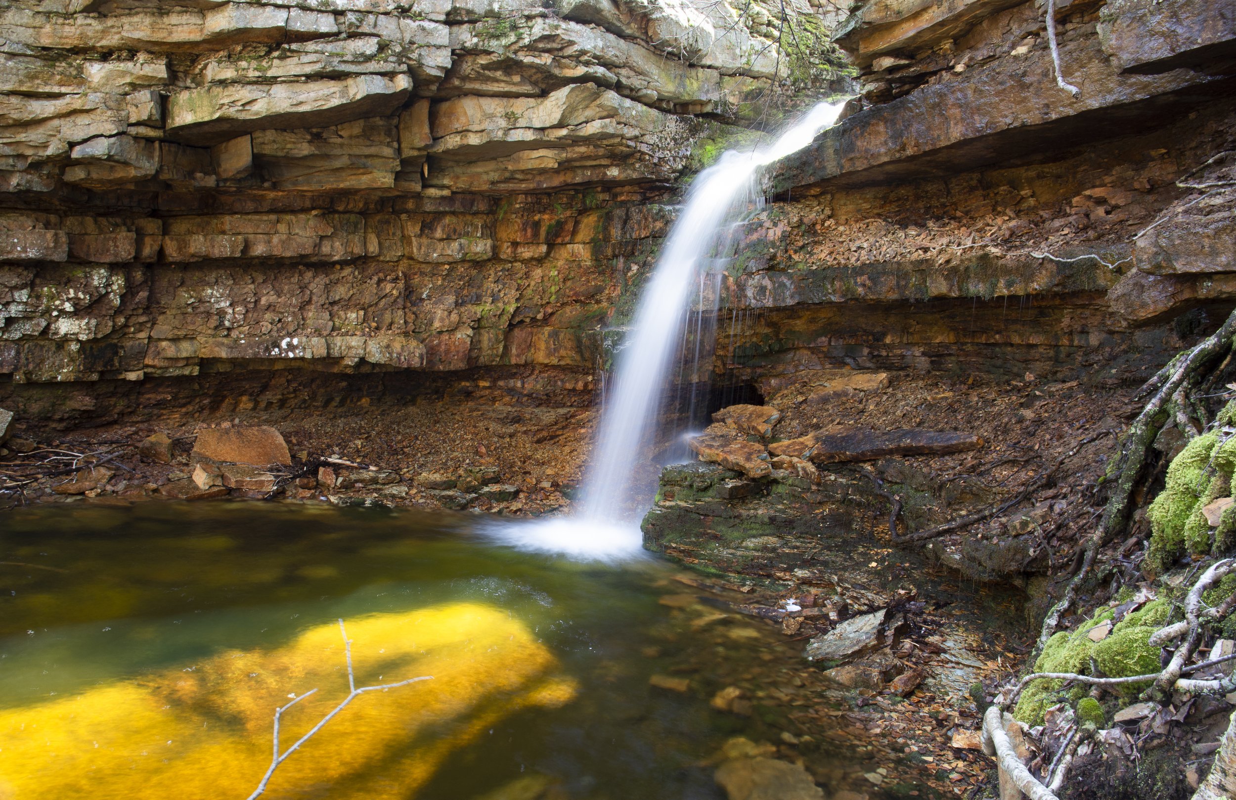
11 - Stony Kills Falls
Beautiful rocky hike to falls. Includes scenic bridge with straight-on view to falls. Recently constructed stone steps allow for hiking to the top of the falls with more sights to explore. As with most Shawangunk waterfalls, crystal clear, pristine water. Use caution at the top. NYNJTC Map 104 Shawangunk (South).
-

12 - North Gully Falls
The views from the road are outstanding. A hike up the leftside (north bank) opens to great views of the Grotto, a small but spectacular erosion canyon into the side of the mountain. The head of the Grotto is marked by a pothole formation known as the Giant's Footprint. The trail is steep and dangerous in spots. Use caution. NYNJTC Map 104 Shawangunk (South).
-

13 - Buttermilk Falls
The waterfall is tall and slides down the side of the mountain base. There is an old mine shaft behind the bottom of the waterfall. The O&W rail trail runs right past the waterfall, and provides for additional exploration to the north. Located in Shawangunk Ridge State Forest, off Lewis Rd past the Spring Glen campground. NYNJTC Map 106B Shawangunk Ridge.
-

14 - Verkeerderkill Falls
Spectacular waterfalls with great views, and the backcountry Shawangunk experience. Well worth visiting. The highest in the Shawangunks.Long, scenic hike along the east face of the ridge. NYNJTC Map 104 Shawangunk (South).
-

15 - Vernooy Kill Falls
Hilly, but not mountanous hike to lovely series of waterfalls. Vernooy Kill Falls are scenic,classic Catskill waterfalls over a series of cascades. NYNJTC Map 143 Catskills South.
-

16 - Peekamoose Buttermilk Falls
Buttermilk Falls is one of several waterfalls in the Peekamoose Valley. In wet times, the many waterfalls are apparent through the valley. In dryer times, Buttermilk Falls remains flowing. The area is well worth exploring by foot, bicycle or car. Parking permit restrictions apply in peak season. NYNJTC Map 143 Catskills South.

LANDMARKS
-
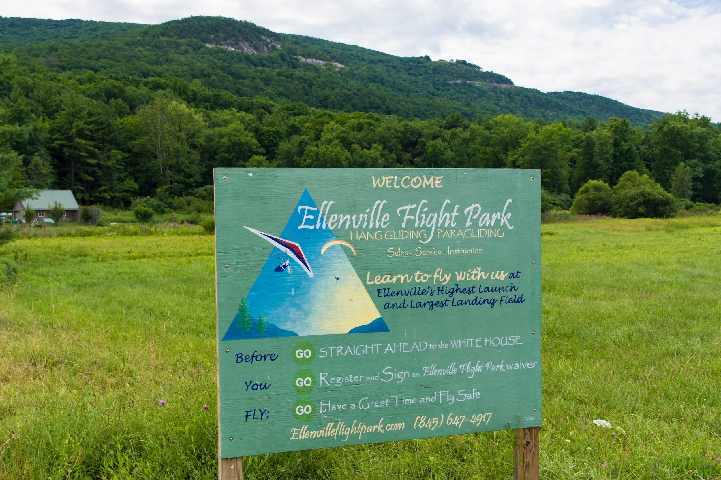
17 - Hang Glider Landing Site
Visit the Ellenville Flight Park at the end of Hang Glider Rd. to get an up close view of hang gliders flying and landing. It's exciting to watch the hang gliders in action. You can also get a sense of the area's agricultural roots from this location, as you'll be surrounded by active and dormant farm land.
-

18 - Liberty Square
The Boy With the Boot fountain has been an Ellenville landmark for many years. The statue can be found in various other locations around the country, but Ellenville has made the statue its own trademerak. The local Dutch Colonial design of Ellenville's post office was encouraged by Franklin Roosevely. FDR later visited Ellenville to dedicate the new post office. The Hunt Memorial building is the centerpiece of Liberty Square. The building was recently renovated and is the site of various community events.
-
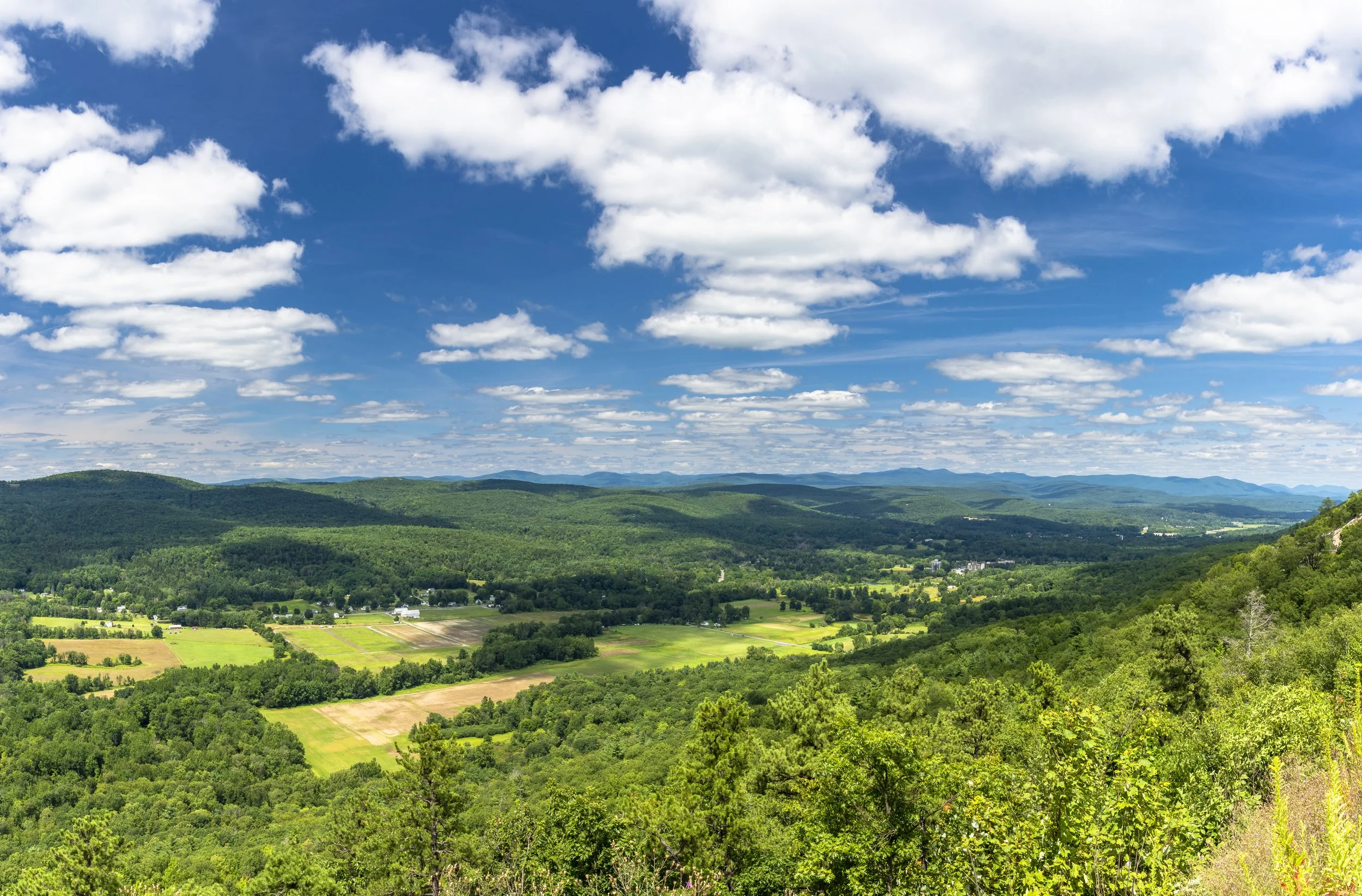
19 - Shawangunk Mountains Scenic Overlook
The Shawangunk Mountains Scenic Byway's overlook here has parking, informational signage and outstanding viewpoints of Ellenville, the Rondout Valley and the Catskills. You can spot many Catskill high peaks here, as well as enjoy outstanding sunset views.
-

20 - Cragsmoor Stone Church - Chapel of the Holy Name
Designed by local artist Frederick Dellenbaugh for Eliza Hartshorn, who erected the chapel in memory of her husband. The building is famous for is mountaintop setting, great views from the yard and the beautiful interior of the building.
-
21 - Bald Eagle Nest View Point
The NYCDEP established a viewing area on the western end of the Rondout Reservoir on Rt 55A. The viewing area provides opportunities to view bald eagles in their native habitat and nests high in the pine trees on the western shore of the reservoir.
-
22 - Berme Road Park
Berme Rd., Ellenville. The park includes a playground, tennis courts basketball courts a picnic pavilion and the gateway to the Smiley Road carriageway into the Shawangunks & Minnewaska Park.
-
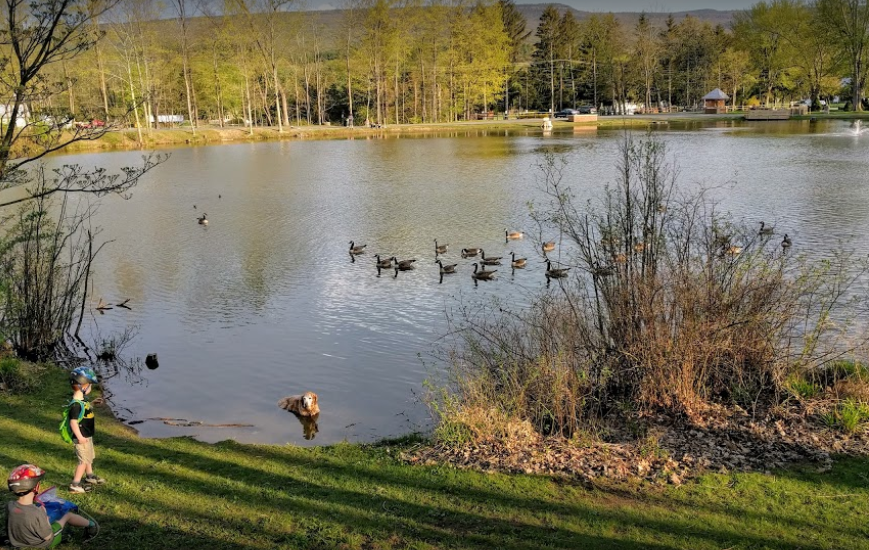
23 - Lippman Park
Rt 209 Wawarsing. Town park with picnic area, recreation facilities, a small pond and a large network of mountain bike trails. Trails alos good for walking, snowshoeing and XC skiing.